Journal of Maps | 2021 | Academic
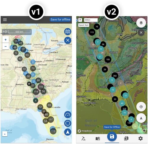
Abstract: Technology has transformed maps into interactive tools for exploring and understanding the world. In this article, we present the user experience (UX) design process for Flyover Country (http://flyovercountry.io), a mobile mapping application that visualizes information about the Earth’s geology and history, allowing users to save and then access the information offline while flying, driving, or hiking. Specifically, the paper presents a UX design study that tracks the conceptualization, implementation, and revision of Flyover Country, and employs scenario-based design to walk through a pair of use case scenarios that informed our UX design: science outreach to the general public and field trip guides for geoscience education. In the paper, we note UX design insights that are potentially transferable to other mobile mapping contexts, organizing insights by mobile representation design (scale, projection, symbolization, and typography) versus mobile interaction design (map entry point, bottom navigation, floating action button, and pull-up information panel). . . .


